中国=タジキスタン国境

中国=タジキスタン国境(ちゅうごく=タジキスタンこっきょう)は、中華人民共和国とタジキスタンの国境である。キルギスとの三国国境から、パミール高原をほぼ南北に走り、アフガニスタンとの三国国境まで続き、全長は477キロメートルある[1]。タジキスタン側はゴルノ・バダフシャン自治州ムルガブ、中国側は新疆ウイグル自治区のクズルス・キルギス自治州アクト県とカシュガル地区タシュクルガン・タジク自治県が接している。
歴史
[編集]

この国境の起源は、19世紀半ばにロシア帝国が中央アジアに進出し、ザイサン湖周辺の支配権を確立したことに始まる。1860年の北京条約で定められたロシア帝国と清国との国境は、現在の中国・カザフスタン・キルギス・タジキスタンの国境とほとんど変わらない[2][3]。この条約に基づき、タルバガタイ条約(1864年)とウリアスハイ条約(1870年)によって国境線の詳細が決定され、ザイサン湖はロシア側に残された[4][5][3]。回民蜂起によって、清国のエルティシ盆地の駐留地は崩壊した。反乱が鎮圧され、左宗棠が新疆を再征服した後、イリ条約とその後の議定書によって、イリ川流域のロシア帝国と清国の国境は、ロシア側に有利にに変更された[3]。1915年には、イリ川流域とジュンガル・アラタウ山脈の国境をより正確に定める協定が結ばれた[3]。国境の最南端(現在の中国とタジキスタンの国境の南半分)は、中央アジアの覇権をめぐるイギリスとロシアの対立(グレートゲーム)が続いていたこともあって、未画定だった。最終的には、アフガニスタンをロシアとイギリス領インドの緩衝国として独立させることで合意し、1895年にアフガニスタンのワハーン回廊が設定された[3]。中国はこの協定に参加していなかったため、中露の境界の最南端は未確定だった[3][6]。1991年に独立したタジキスタンは、中ソ国境の一部を継承した。その国境線は、アムダリヤ川とヤルカンド川の分水嶺に沿って、マルカンスに達するまで続いている[3]:10。
タジキスタンが1999年の協定と2002年の補足協定に2011年に批准したことで、パミール高原の200平方キロメートルと1,122平方キロメートルの土地[7]がタジキスタンから中華人民共和国に割譲され、130年に及ぶ紛争に終止符を打った。この条約により、中国はタジキスタンが支配する領土28,000平方キロメートルの領有権を放棄した[8][9][7]。この国境条約に対し、タジキスタン人の間では賛成・反対で大きく意見が分かれた[10]。
2020年7月、タジキスタンは中国にもっと土地を割譲するべきだとするCho Yao Luの記事が中国国内のメディアに掲載され、タジキスタンとロシアから激しい反発を受けた[11][12][13][14]。
地理
[編集]国境の北端は、キルギスとの三国国境である。マルカンス川(瑪爾坎蘇河)の源流付近であり、近くには中国の最西端地点がある。
国境の南端は、アフガニスタンとの三国国境で、ポバロ・シュヴェイコフスコゴ峰[15][16](波万洛什维科夫斯基峰[17])という。アフガニスタン=タジキスタン国境の東端、アフガニスタン=中国国境の北端であり、アフガニスタンの最東端である。
国境通過点
[編集]カルマ峠(闊勒買山口、標高4,362.7メートル)にあるカラス口岸(卡拉蘇口岸)が、現在の中国=タジキスタン国境における唯一の通過点である[18]。歴史的には、その南にあるネザタシュ峠やベイク峠も使用されていた。
地図
[編集]20世紀半ばから後半にかけての中国=ソ連(タジク・ソビエト社会主義共和国)の国境地帯の地図と、2011年以前の中国=タジキスタン国境を含む歴史地図。
-
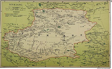
現在のタジキスタンの地域の中国=ロシア国境の地図(1917年)
-
100万分の1国際図(1966年)[注釈 1]
-
アフガニスタン=中国国境の地図(アフガニスタン=中国=ソ連の三国国境を"PEAK POVALO SHVEIKOVSKI 5698 (18694)"と表示している。(1969年)[注釈 2]
-
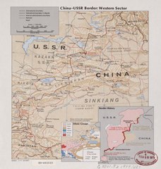
中国=ソ連国境の西部の地図。中国が領有を主張する地域が示されている。
-
国境地帯(1980年、アメリカ防衛地図局)[注釈 3]
-
国境の北部・西部(1981年、アメリカ防衛地図局)[注釈 3]
-
国境の南部・東部(1984年、アメリカ防衛地図局)[注釈 3]
-
タシュクルガン鎮付近の中国=ソ連国境を含む地図(1985年、アメリカ防衛地図局)
-
中国=ソ連国境の一部(1989年、アメリカ防衛地図局)
-
中国=ソ連国境の一部(1988年、アメリカ防衛地図局)[注釈 3]
-
アフガニスタンとの三国国境を含む、中国=タジキスタン国境の一部("BOUNDARY IN DISPUTE"(紛争中の境界)と表示されている)(1992年、アメリカ防衛地図局)[注釈 3]
-
中国=タジキスタン国境の地図(2001年)
脚注
[編集]注釈
[編集]出典
[編集]- ^ “FIELD LISTING :: LAND BOUNDARIES”. The World Factbook. 30 January 2020閲覧。 “China total: 22,457 km border countries (15):{...}Tajikistan 477 km, {...}Tajikistan total: 4,130 km border countries (4): {...}China 477 km, {...”}
- ^ Articles 2 and 3 in the Russian text of the treaty
- ^ a b c d e f g International Boundary Study No. 64 – China-USSR Boundary, (13 February 1978), オリジナルの17 August 2014時点におけるアーカイブ。 23 September 2018閲覧。
- ^ (See the map)
- ^ The Lost Frontier: the treaty maps that changed Qing's northwestern boundaries
- ^ CIA (1977年). “China Oil Production Prospects”. p. 2. 2021年11月13日閲覧。 (Note: In the map, the southern part of the border is drawn with a dotted line, whereas the northern part of the border is drawn with a solid line.)
- ^ a b Alex Sodiqov (24 January 2011). “Tajikistan cedes disputed land to China”. Eurasia Daily Monitor (Jamestown Foundation) 8 (16) 23 September 2018閲覧. "On January 12, the lower house of the Tajik parliament voted to ratify the 2002 border demarcation agreement, handing over 1,122 square kilometers (433 square miles) of mountainous land in the remote Pamir Mountains (www.asiaplus.tj, January 12). The ceded land represents about 0.8 percent of the country’s total area of 143,100 square kilometers (55,250 square miles).{...}At the time of independence, Tajikistan inherited three disputed border segments, constituting about 28,500 square kilometers (11,000 square miles), which China and the Soviet Union had been unable to resolve. In 1999, Tajikistan and China signed a border demarcation agreement, defining the border in two of the three segments. Under the 1999 deal, Dushanbe ceded about 200 square kilometers (77 square miles) of land to Beijing (http://www.ca-oasis.info/oasis/?jrn=109&id=817)."
- ^ “Tajikistan cedes land to China”. BBC News. (13 January 2011) 3 May 2016閲覧。
- ^ “China's area increases by 1000 sq km”. Times of India. (12 January 2011). オリジナルの2011年1月16日時点におけるアーカイブ。 3 May 2016閲覧。
- ^ Assel Bitabarova (January 2015). “Contested Views of Contested Territories: How Tajik Society Views the Tajik-Chinese Border Settlement”. Eurasia Border Review 21 January 2020閲覧。.
- ^ Paul Goble (30 July 2020). “Beijing Implies Tajikistan's Pamir Region Should Be Returned to China”. Eurasia Daily Monitor 17 (112) 7 August 2020閲覧。.
- ^ “Now, China eyes Pamir region in Tajikistan”. WION (4 August 2020). 7 August 2020閲覧。 “'Pamir was outside China [for] 128 years due to the pressure of world powers', these are the words of Cho Yau Lu.”
- ^ Yau Tsz Yan (3 August 2020). “China business briefing: Unclear borders, uneasy neighbors”. Eurasianet. 7 August 2020閲覧。 “Days later, an article appeared in Chinese news outlets claiming that Tajikistan’s Pamir mountains historically belonged to China and should be returned. Though the article was penned by a nationalist historian and does not appear to be a veiled hint from the Party, the message hit Dushanbe in a sensitive spot. Tajik officials are perennially concerned about the Pamirs, a region where they have tenuous authority over the local population.”
- ^ “Пекин претендует на Памир? Что пишут китайские СМИ о таджиках и о Таджикистане?”. 2021年11月13日閲覧。
- ^ Kamoludin Abdullaev (2018). Historical Dictionary of Tajikistan (3 ed.). Rowman & Littlefield. p. 92. ISBN 9781538102527. "CHINA-TAJIK BORDER.{...}This mountainous boundary runs along the Sarikol mountain range in eastern Tajikistan, reaching in Pamir the Afghan border at the Povalo-Shveikovskogo peak (5,543 meters above sea level)."
- ^ “NJ 43 Su-fu [U.S.S.R., China, Afghanistan, Pakistan, State of Jammu and Kashmir Series 1301, Edition 5-AMS]” (英語). Washington, D. C.: Army Map Service (March 1967). 2021年11月13日閲覧。 “Pik Povalo-Shveikovskogo”
- ^ “中华人民共和国和阿富汗王国边界条约” (中国語) (22 November 1963). 2021年11月13日閲覧。 “到高程为5698米的克克拉去考勒峰(阿方图称波万洛什维科夫斯基峰)。”
- ^ Caravanistan - Tajikistan border crossings 23 September 2018閲覧。


![100万分の1国際図(1966年)[注釈 1]](http://upload.wikimedia.org/wikipedia/commons/thumb/a/ae/Txu-oclc-6654394-nj-43-5th-ed.jpg/215px-Txu-oclc-6654394-nj-43-5th-ed.jpg)
![アフガニスタン=中国国境の地図(アフガニスタン=中国=ソ連の三国国境を"PEAK POVALO SHVEIKOVSKI 5698 (18694)"と表示している。(1969年)[注釈 2]](http://upload.wikimedia.org/wikipedia/commons/thumb/4/4c/Afghanistan-China_Boundary._4-69._LOC_gm70003373_cropped.jpg/313px-Afghanistan-China_Boundary._4-69._LOC_gm70003373_cropped.jpg)

![国境地帯(1980年、アメリカ防衛地図局)[注釈 3]](http://upload.wikimedia.org/wikipedia/commons/thumb/f/fb/Operational_Navigation_Chart_G-7%2C_6th_edition.jpg/331px-Operational_Navigation_Chart_G-7%2C_6th_edition.jpg)
![国境の北部・西部(1981年、アメリカ防衛地図局)[注釈 3]](http://upload.wikimedia.org/wikipedia/commons/thumb/b/bb/Txu-pclmaps-oclc-22834566_g-6b.jpg/321px-Txu-pclmaps-oclc-22834566_g-6b.jpg)
![国境の南部・東部(1984年、アメリカ防衛地図局)[注釈 3]](http://upload.wikimedia.org/wikipedia/commons/thumb/a/a1/Txu-pclmaps-oclc-22834566_g-7a.jpg/335px-Txu-pclmaps-oclc-22834566_g-7a.jpg)


![中国=ソ連国境の一部(1988年、アメリカ防衛地図局)[注釈 3]](http://upload.wikimedia.org/wikipedia/commons/thumb/1/1d/Txu-oclc-224033229-nj43-06.jpg/321px-Txu-oclc-224033229-nj43-06.jpg)
![アフガニスタンとの三国国境を含む、中国=タジキスタン国境の一部("BOUNDARY IN DISPUTE"(紛争中の境界)と表示されている)(1992年、アメリカ防衛地図局)[注釈 3]](http://upload.wikimedia.org/wikipedia/commons/thumb/9/92/Txu-oclc-224033229-nj43-10.jpg/318px-Txu-oclc-224033229-nj43-10.jpg)
