Template:Location map/testcases
| ここは、Template:Location mapのサンドボックス・サブページに対応したテンプレート・テストケースです。 右のボタンをクリックするとテストケースが更新されます。 更なる情報とオプション このページに複雑なテンプレートの使用例を多く記述した場合、MediaWikiの制限によりページの終端部周辺で誤動作を起こす可能性があります。この誤動作が発生した場合、発生したページのソースに追加された「NewPP limit report」というコメントを参照してください。
また、特別:テンプレートを展開でテンプレートの使用結果を実験することも出来ます。 このページを表示する外装を変更する: |
Proposed Changes by Bellezzasolo
[編集]{{Location map
| Oxford (central)#United Kingdom Oxford
| float = left
|coordinates = {{coord|51.762123|-1.261974|display=inline,title}}
|float = left
|border = infobox
|caption =
|width = 300
}}
| {{Location map}} | {{Location map/sandbox}} |
|---|---|
Flagged as potential problems with above change
[編集]See also Template:Location map many/testcases and Template:Location map+/testcases
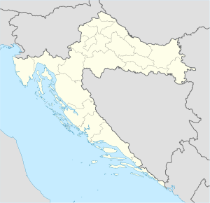
Croatia
[編集]{{Location map|Croatia
| label = Pag
| mark = <!--dot--> Green pog.svg
| lat_deg = 44
| lat_min = 26
| lon_deg = 15
| lon_min = 3
| position = right
| width = 300
| float = right
}}
| {{Location map}} | {{Location map/sandbox}} |
|---|---|
Croatia 2
[編集]{{Location map|Croatia
| label = Pag
| lat = 44.44
| long = 15.05
| position = right
| width = 200
| float = right
}}
| {{Location map}} | {{Location map/sandbox}} |
|---|---|
Croatia 3
[編集]{{Location map|Croatia
| label = Pag
| alt = Pag lies off the West coast of Croatia, in the Adriatic Sea
| mark = <!--dot-->Green pog.svg
| lat_deg = 44
| lat_min = 26
| lon_deg = 15
| lon_min = 3
| position = right
| width = 300
| float = right
}}
| {{Location map}} | {{Location map/sandbox}} |
|---|---|
Croatia 4
[編集]{{Location map|Croatia
| label = Imotski
| lat = 43.44
| long = 17.21
| position = right
| width = 300
| float = right
| background = #FFFFDD
| caption = Imotski on the map of Croatia
}}
| {{Location map}} | {{Location map/sandbox}} |
|---|---|
Croatia 5
[編集]{{Location map|Croatia
| label = Pag
| label_size = 200
| lat = 44.44
| long = 15.05
| position = right
| width = 300
| float = right
| background = #FFFFDD
| caption = Pag Island on the map of Croatia
}}
| {{Location map}} | {{Location map/sandbox}} |
|---|---|
Bosnia
[編集]{{Location map|Bosnia
| label = Brčko
| position = left
| width = 150
| lat = 44.87
| long = 18.81
| float = right
| caption =
}}
| {{Location map}} | {{Location map/sandbox}} |
|---|---|
Ghana
[編集]{{Location map|Ghana
| label = Tema
| coordinates = {{coord|05|40|N|00|00|W}}
| width = 150
| float = right
}}
| {{Location map}} | {{Location map/sandbox}} |
|---|---|
Scotland
[編集]{{Location map|UK Scotland
| label = Lockerbie
| marksize = 9
| mark = Blue_pog.svg
| lat_dir = N
| lat_deg = 55
| lat_min = 7
| lat_sec = 16
| lon_dir = W
| lon_deg = 3
| lon_min = 21
| lon_sec = 19
| position = right
| width = 170
| float = right
| caption = Lockerbie in Scotland
}}
| {{Location map}} | {{Location map/sandbox}} |
|---|---|
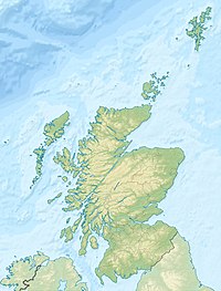
Scotland relief
[編集]{{Location map|UK Scotland
| lat_deg = 55 | lat_min = 07 | lat_sec = 16 | lat_dir = N
| lon_deg = 03 | lon_min = 21 | lon_sec = 19 | lon_dir = W
| label = Lockerbie
| position = right
| mark = Blue_pog.svg
| marksize = 9
| width = 200
| relief = yes
| float = right
| caption = Lockerbie in Scotland
| alt = Lockerbie is in southern Scotland.
}}
| {{Location map}} | {{Location map/sandbox}} |
|---|---|
Russia
[編集]{{Location map|Russia
| label = Uelen
| marksize = 7
| mark = Locator_Dot.png
| lat_deg = 66
| lat_min = 09
| lat_dir = N
| lon_deg = 169
| lon_min = 48
| lon_dir = W
| position = left
| width = 500
| float = left
| background = yellow
}}
| {{Location map}} | {{Location map/sandbox}} |
|---|---|
Russia 2
[編集]Exercise max_width
{{Location map|Russia
| label      = Uelen
| marksize   = 7
| mark       = Locator_Dot.png
| lat_deg    = 66
| lat_min    = 09
| lat_dir    = N
| lon_deg    = 169
| lon_min    = 48
| lon_dir    = W
| position   = left
| width      = 500
| float      = left
| background = yellow
| max_width  = 300
}}
| {{Location map}} | {{Location map/sandbox}} |
|---|---|
Belgium
[編集]Float left
[編集]Walraversijde was discovered on the Belgian coast by the archeologist Marnix Pieters in 1992 in a dune area, near a medieval dyke. Prior to discovery, Walraversijde was a lost village, with no obvious remains above ground. Two related sites were excavated, one on a beach and the other on a polder. The beach site was inhabited between 1200 and 1400, and the polder site was inhabited between 1400 and 1630. The excavations also found evidence of activities during the Roman era, such as a Roman dyke.
Walraversijde played a role during the Siege of Ostend of 1601-1604, when a Spanish cavalry camp operated from the site. The artefacts and remains are well preserved, and there have been many finds. The sites have been excavated systematically and thoroughly, and have produced unusually rich findings.
Image thumb float left

Walraversijde was discovered on the Belgian coast by the archeologist Marnix Pieters in 1992 in a dune area, near a medieval dyke. Prior to discovery, Walraversijde was a lost village, with no obvious remains above ground. Two related sites were excavated, one on a beach and the other on a polder. The beach site was inhabited between 1200 and 1400, and the polder site was inhabited between 1400 and 1630. The excavations also found evidence of activities during the Roman era, such as a Roman dyke.
Walraversijde played a role during the Siege of Ostend of 1601-1604, when a Spanish cavalry camp operated from the site. The artefacts and remains are well preserved, and there have been many finds. The sites have been excavated systematically and thoroughly, and have produced unusually rich findings.
Float center
[編集]Walraversijde was discovered on the Belgian coast by the archeologist Marnix Pieters in 1992 in a dune area, near a medieval dyke. Prior to discovery, Walraversijde was a lost village, with no obvious remains above ground. Two related sites were excavated, one on a beach and the other on a polder. The beach site was inhabited between 1200 and 1400, and the polder site was inhabited between 1400 and 1630. The excavations also found evidence of activities during the Roman era, such as a Roman dyke.
Walraversijde played a role during the Siege of Ostend of 1601-1604, when a Spanish cavalry camp operated from the site. The artefacts and remains are well preserved, and there have been many finds. The sites have been excavated systematically and thoroughly, and have produced unusually rich findings.
Image thumb float center

Walraversijde was discovered on the Belgian coast by the archeologist Marnix Pieters in 1992 in a dune area, near a medieval dyke. Prior to discovery, Walraversijde was a lost village, with no obvious remains above ground. Two related sites were excavated, one on a beach and the other on a polder. The beach site was inhabited between 1200 and 1400, and the polder site was inhabited between 1400 and 1630. The excavations also found evidence of activities during the Roman era, such as a Roman dyke.
Walraversijde played a role during the Siege of Ostend of 1601-1604, when a Spanish cavalry camp operated from the site. The artefacts and remains are well preserved, and there have been many finds. The sites have been excavated systematically and thoroughly, and have produced unusually rich findings.
Float right
[編集]Walraversijde was discovered on the Belgian coast by the archeologist Marnix Pieters in 1992 in a dune area, near a medieval dyke. Prior to discovery, Walraversijde was a lost village, with no obvious remains above ground. Two related sites were excavated, one on a beach and the other on a polder. The beach site was inhabited between 1200 and 1400, and the polder site was inhabited between 1400 and 1630. The excavations also found evidence of activities during the Roman era, such as a Roman dyke.
Walraversijde played a role during the Siege of Ostend of 1601-1604, when a Spanish cavalry camp operated from the site. The artefacts and remains are well preserved, and there have been many finds. The sites have been excavated systematically and thoroughly, and have produced unusually rich findings.
Image thumb float right

Walraversijde was discovered on the Belgian coast by the archeologist Marnix Pieters in 1992 in a dune area, near a medieval dyke. Prior to discovery, Walraversijde was a lost village, with no obvious remains above ground. Two related sites were excavated, one on a beach and the other on a polder. The beach site was inhabited between 1200 and 1400, and the polder site was inhabited between 1400 and 1630. The excavations also found evidence of activities during the Roman era, such as a Roman dyke.
Walraversijde played a role during the Siege of Ostend of 1601-1604, when a Spanish cavalry camp operated from the site. The artefacts and remains are well preserved, and there have been many finds. The sites have been excavated systematically and thoroughly, and have produced unusually rich findings.
Exercise float
[編集]Sandbox
[編集]- left
- right
- none
- default
Live
[編集]- left
- right
- none
- default


