Template:Infobox Settlement/metriconlyを使用
{{Infobox Settlement/sandbox
|name = 糸屋町
|settlement_type = [[町丁]]
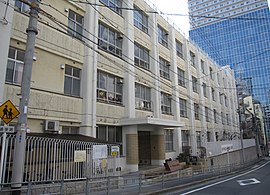
|image_skyline = Osaka City Naka Ooe elementary school.JPG
|imagesize = 270px
|image_caption = [[大阪市立中大江小学校]]
|image_map =
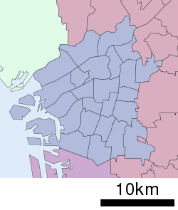
|map_caption = 糸屋町の位置
|pushpin_map = Japan Wards of Osaka#Japan Osaka
|latd = 34 |latm = 41 |lats = 6.78 |latNS = N
|longd = 135 |longm = 30 |longs = 49.74 |longEW = E
|subdivision_type = [[国の一覧|国]]
|subdivision_name = {{JPN}}
|subdivision_type1 = [[都道府県]]
|subdivision_name1 = [[File:Flag of Osaka Prefecture.svg|border|25px]] [[大阪府]]
|subdivision_type2 = [[市町村]]
|subdivision_name2 = [[File:Flag of Osaka, Osaka.svg|border|25px]] [[大阪市]]
|subdivision_type3 = [[区 (行政区画)|区]]
|subdivision_name3 = [[中央区 (大阪市)|中央区]]
|established_title1 = <!-- 町名制定 -->
|established_date1 = <!-- 制定日 -->
|area_footnotes = <ref name="area">{{Cite web |url=https://toukei-labo.com/2015/?tdfk=27&city=27128 |title=大阪府大阪市中央区の町丁・字一覧 |publisher=人口統計ラボ |accessdate=2019-10-04}}</ref>
|area_total_km2 = 0.041388012
|elevation_footnotes = <!-- 標高(<ref>) -->
|elevation_m = <!-- 標高 -->
|population_as_of = [[2019年]](平成31年)[[3月31日]]現在
|population_footnotes = <ref name="population">{{Cite web |url=https://www.city.osaka.lg.jp/shimin/page/0000006893.html |title=住民基本台帳人口・外国人人口 |publisher=大阪市 |date=2019-07-26 |accessdate=2019-10-04}}</ref>
|population_total = 1296
|population_density_km2 = auto
|timezone1 = [[日本標準時]]
|utc_offset1 = +9
|postal_code_type = [[日本の郵便番号|郵便番号]]
|postal_code = 540-0022<ref name="postal">{{Cite web |url=https://www.post.japanpost.jp/cgi-zip/zipcode.php?zip=5400022 |title=糸屋町の郵便番号 |publisher=[[日本郵便]] |accessdate=2019-08-15}}</ref>
|area_code = 06([[日本の市外局番#番号区画|大阪MA]])<ref name="areacode">{{Cite web |url=https://www.soumu.go.jp/main_sosiki/joho_tsusin/top/tel_number/shigai_list.html |title=市外局番の一覧 |publisher=総務省 |accessdate=2019-06-24}}</ref>
|registration_plate = [[大阪運輸支局|なにわ]]
|footnotes =
}}
{{Infobox Settlement/sandbox
|name = 日本例1
|subdivision_name = {{JPN}}
|area_total_km2 = 0.041388012
|population_total = 1296
|population_density_km2 = 31609
}}
日本例1
面積
• 合計
0.041388012km2 人口
• 合計
1,296人 • 密度
31,609人/km2
{{Infobox Settlement/sandbox
|name = 日本例2
|subdivision_name = {{JPN}}
|area_total_km2 = 0.041388012
|population_total = 1296
|population_density_km2 =
}}
日本例2
面積
• 合計
0.041388012km2 人口
• 合計
1,296人
{{Infobox Settlement/sandbox
|name = 日本例3/面積がない・autoはFNE
|subdivision_name = {{JPN}}
|area_total_km2 =
|population_total = 1296
|population_density_km2 =auto
}}
Template:Infobox Settlement/impusを使用
{{Infobox Settlement/sandbox
|name                     = アメリカ都市1
|subdivision_name         = {{USA}}
|unit_pref  =  Imperial
|area_magnitude           =
|area_total_km2           = 25.3
|population_total         = 13121
|population_density_km2   = auto
|population_density_sq_mi =
アメリカ都市
面積
• 合計
9.8mi2 (25.3km2 ) 人口
• 合計
13,121人 • 密度
1,300人/mi2 (520人/km2 )
{{Infobox Settlement/sandbox
|name                     = アメリカ都市2
|subdivision_name         = {{USA}}
|unit_pref  =  Imperial
|area_magnitude           =
|area_total_km2           =
|population_total         = 13121
|population_density_km2   = auto
|population_density_sq_mi =
{{Infobox Settlement/sandbox
|name                     = アメリカ都市3
|subdivision_name         = {{USA}}
|unit_pref  =  Imperial
|area_magnitude           =
|area_total_km2           = 25.3
|population_total         = 13121
|population_density_km2   = 442.4
|population_density_sq_mi =
アメリカ都市3
面積
• 合計
9.8mi2 (25.3km2 ) 人口
• 合計
13,121人 • 密度
1,146人/mi2 (442.4人/km2 )
Template:Infobox Settlement/metricを使用
{{Infobox Settlement/sandbox
|name = エディンバラ1
|subdivision_name = {{GBR}}
<!-- Area --------------------->
|area_magnitude =
|unit_pref =
|area_total_km2 = 100
|area_total_sq_mi =
|population_total = 100000
|population_density_km2 =auto
|population_density_sq_mi =auto
}}
エディンバラ1
面積
• 合計
100km2 (40mi2 ) 人口
• 合計
100,000人 • 密度
1,000人/km2 (2,600人/mi2 )
{{Infobox Settlement/sandbox
|name = エディンバラ2
|subdivision_name = {{GBR}}
<!-- Area --------------------->
|area_magnitude =
|unit_pref =
|area_total_km2 = 100
|area_total_sq_mi =
|population_total = 100000
|population_density_km2 =auto
|population_density_sq_mi =40
}}
エディンバラ2
面積
• 合計
100km2 (40mi2 ) 人口
• 合計
100,000人 • 密度
1,000人/km2 (40人/mi2 )
{{Infobox Settlement/sandbox
|name = エディンバラ3
|subdivision_name = {{GBR}}
<!-- Area --------------------->
|area_magnitude =
|unit_pref =
|area_total_km2 = 100
|area_total_sq_mi =
|population_total = 100000
|population_density_km2 =auto
|population_density_sq_mi =
}}
エディンバラ3
面積
• 合計
100km2 (40mi2 ) 人口
• 合計
100,000人 • 密度
1,000人/km2 (2,600人/mi2 )
{{Infobox Settlement/sandbox
|name = エディンバラ4
|subdivision_name = {{GBR}}
<!-- Area --------------------->
|area_magnitude =
|unit_pref =
|area_total_km2 = 100
|area_total_sq_mi =
|population_total = 100000
|population_density_km2 =1000
|population_density_sq_mi =auto
}}
エディンバラ4
面積
• 合計
100km2 (40mi2 ) 人口
• 合計
100,000人 • 密度
1,000人/km2 (2,600人/mi2 )
{{Infobox Settlement/sandbox
|name = エディンバラ5
|subdivision_name = {{GBR}}
<!-- Area --------------------->
|area_magnitude =
|unit_pref =
|area_total_km2 = 100
|area_total_sq_mi =
|population_total = 100000
|population_density_km2 =1000
|population_density_sq_mi =
}}
エディンバラ5
面積
• 合計
100km2 (40mi2 ) 人口
• 合計
100,000人 • 密度
1,000人/km2 (3,000人/mi2 )
{{Infobox Settlement/sandbox
|name = エディンバラ6
|subdivision_name = {{GBR}}
<!-- Area --------------------->
|area_magnitude =
|unit_pref =
|area_total_km2 =
|area_total_sq_mi =40
|population_total = 100000
|population_density_km2 =
|population_density_sq_mi =auto
}}
エディンバラ6
面積
• 合計
100km2 (40mi2 ) 人口
• 合計
100,000人 • 密度
970人/km2 (2,500人/mi2 )
{{Infobox Settlement/sandbox
|name = エディンバラ7
|subdivision_name = {{GBR}}
<!-- Area --------------------->
|area_magnitude =
|unit_pref =
|area_total_km2 = 100
|area_total_sq_mi =250
|population_total = 100000
|population_density_km2 =1000
|population_density_sq_mi =400
}}
エディンバラ7
面積
• 合計
100km2 (250mi2 ) 人口
• 合計
100,000人 • 密度
1,000人/km2 (400人/mi2 )
1/km/mi/auto/auto
面積
• 合計
100km2 (38.6mi2 ) 人口
• 合計
100,000人 • 密度
1,000人/km2 (2,600人/mi2 )
2/km/mi/数字/数字
面積
• 合計
100km2 (38.6mi2 ) 人口
• 合計
100,000人 • 密度
1,000人/km2 (2,590人/mi2 )
3/km/空/auto/auto
面積
• 合計
100km2 (40mi2 ) 人口
• 合計
100,000人 • 密度
1,000人/km2 (2,600人/mi2 )
4/km/空/auto/空
面積
• 合計
100km2 (40mi2 ) 人口
• 合計
100,000人 • 密度
1,000人/km2 (2,600人/mi2 )
5/km/空/数字/空
面積
• 合計
100km2 (40mi2 ) 人口
• 合計
100,000人 • 密度
1,000人/km2 (3,000人/mi2 )
6/km/空/数字/auto
面積
• 合計
100km2 (40mi2 ) 人口
• 合計
100,000人 • 密度
1,000人/km2 (2,600人/mi2 )
7/km/空/数字/数字
面積
• 合計
100km2 (40mi2 ) 人口
• 合計
100,000人 • 密度
100人/km2 (2,590人/mi2 )
8/km/空/空/auto
面積
• 合計
100km2 (40mi2 ) 人口
• 合計
100,000人 • 密度
1,000人/km2 (2,600人/mi2 )
9/km/空/空/空
面積
• 合計
100km2 (40mi2 ) 人口
• 合計
100,000人
10/km/空/空/数字
面積
• 合計
100km2 (40mi2 ) 人口
• 合計
100,000人 • 密度
1,000人/km2 (2,590人/mi2 )
11/空/mi/空/数字
面積
• 合計
100km2 (38.6mi2 ) 人口
• 合計
100,000人 • 密度
1,000人/km2 (2,590人/mi2 )
12/空/mi/空/auto
面積
• 合計
100km2 (38.6mi2 ) 人口
• 合計
100,000人 • 密度
1,000人/km2 (2,600人/mi2 )
エディンバラ
旗 紋章
愛称 : "Auld Reekie", "Athens of the North"
標語 : "Nisi Dominus Frustra" "Except the Lord in vain" associated with Edinburgh since 1647, it is a normal heraldic contraction of a verse from the 127th Psalm, "Except the Lord build the house, they labour in vain that build it. Except the Lord keep the city, the watchman waketh but in vain"
エディンバラ (エディンバラ)
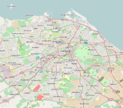
エディンバラの地図を表示 エディンバラ (スコットランド)
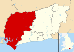
スコットランドの地図を表示
北緯55度56分58秒 西経3度9分37秒 / 北緯55.94944度 西経3.16028度 / 55.94944; -3.16028 国
イギリス カントリー
スコットランド レフテナンシー・エリア
エディンバラ 市役所
エディンバラ・シティ・センター 創立
7世紀 自由都市
1125年 市政移行
1889年 政府
• 種別
単一自治体 、都市 • 市政
シティ・オブ・エディンバラ・カウンシル • 市長
ドナルド・ウィルソン • スコットランド議会議員
• 英国議会議員 :
面積
• 合計
264km2 (102mi2 ) 人口(2012年)
• 合計
482,640人 • 密度
1,828人/km2 (4,730人/mi2 )
[ 13] 等時帯
UTC+0 (グリニッジ標準時 ) • 夏時間
UTC+1 (英国夏時間 ) 郵便地域
市外局番
0131 ISO 3166-2
GB-EDH ONSコード
00QP 英式座標
NT275735 NUTS 3
UKM25 ウェブサイト
www.edinburgh.gov.uk www.edinburgh-inspiringcapital.com
<mapframe>: このJSON コンテンツは正しいGeoJSON+simplestyleではありません。以下の一覧は
JSON スキーマ に従って解釈しようとするすべての試みを示しています。すべてがエラーというわけではありません。
/0/query: The property query is required
/0/ids: The property ids is required
/0: Failed to match at least one schema
/0/title: The property title is required
/0/service: Does not have a value in the enumeration ["page"]
/0: Failed to match exactly one schema
/0/geometries: The property geometries is required
/0/type: Does not have a value in the enumeration ["GeometryCollection"]
/0/type: Does not have a value in the enumeration ["MultiPolygon"]
/0/type: Does not have a value in the enumeration ["Point"]
/0/type: Does not have a value in the enumeration ["MultiPoint"]
/0/type: Does not have a value in the enumeration ["LineString"]
/0/type: Does not have a value in the enumeration ["MultiLineString"]
/0/type: Does not have a value in the enumeration ["Polygon"]
/0/coordinates: The property coordinates is required
/0/geometry: The property geometry is required
/0/type: Does not have a value in the enumeration ["Feature"]
/0/features: The property features is required
/0/type: Does not have a value in the enumeration ["FeatureCollection"]
sita error


