Template:Infobox GER Samtgemeinde/doc
表示
| これはTemplate:Infobox GER Samtgemeindeの解説サブページです。 使用方法、カテゴリ、およびその他テンプレートページ自体に含まれない情報を収容しています。 |
このテンプレートは、ドイツの市町村の基本情報を表示する情報ボックスのテンプレートです。
書式
[編集]{{Infobox GER Samtgemeinde
| 紋章 =
| 郡の位置 =
| 郡内の位置 =
| 行政管区 =
| 郡 =
| 市町村数 =
| 市町村連合 =
| 緯度_度 = | 緯度_分 = | 緯度_秒 =
| 経度_度 = | 経度_分 = | 経度_秒 =
| 標高 =
| ナンバープレート =
| 自治体コード =
| 行政庁舎の住所 =
| ウェブサイト =
| 首長_転写 =
| 首長 =
| 地図のズーム =
}}
用例
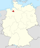
[編集]たとえば、ニーダーザクセン州オスターホルツ郡ザムトゲマインデ・ハムベルゲンの場合、以下のように記述します。右がその場合の表示です。(ただし、WIKIDATA へのリンクがないので、一番下に表示されるOpenStreetMapは表示されていない。)
| 紋章 | 地図 (郡の位置) |
|---|---|

|

|
| 基本情報 | |
| 連邦州: | ニーダーザクセン州 |
| 郡: | オスターホルツ郡 |
| 市町村数: | 5(市)町村 |
| 緯度経度: | 北緯53度18分 東経08度51分 / 北緯53.300度 東経8.850度座標: 北緯53度18分 東経08度51分 / 北緯53.300度 東経8.850度 |
| 面積: | 135.3 km2 |
| 人口: |
12,087人(2023年12月31日現在) [1] |
| 人口密度: | 89 人/km2 |
| ナンバープレート: | OHZ |
| 自治体コード: |
03 3 56 5401 |
| 行政庁舎の住所: | Bremer Straße 2 27729 Hambergen |
| ウェブサイト: | www.hambergen.de |
| 首長: | ラインハルト・コック (Reinhard Kock) |
| 郡内の位置 | |

| |
| 地図 | |
<mapframe>: このJSON コンテンツは正しいGeoJSON+simplestyleではありません。以下の一覧はJSON スキーマに従って解釈しようとするすべての試みを示しています。すべてがエラーというわけではありません。
| |
{{Infobox GER Samtgemeinde
| 紋章 = DEU Hambergen SG COA.svg
| 郡の位置 = Locator map OHZ in Germany.svg
| 郡内の位置 = Samtgemeinde Hambergen in OHZ.svg
| 行政管区 =
| 郡 = オスターホルツ郡
| 市町村連合 =
| 市町村数 = 5
| 緯度_度 = 53 | 緯度_分 = 18 | 緯度_秒 =
| 経度_度 = 08 | 経度_分 = 51 | 経度_秒 =
| 標高 =
| ナンバープレート = OHZ
| 自治体コード = 033565401
| 行政庁舎の住所 = Bremer Straße 2<br />27729 Hambergen
| ウェブサイト = [http://www.hambergen.de/ www.hambergen.de]
| 首長_転写 = ラインハルト・コック
| 首長 = Reinhard Kock
| 地図のズーム = 10
}}
パラメータ
[編集]| パラメータ | 解説 |
|---|---|
| 紋章 | 紋章の画像ファイル名を指定します。File:などのprefixは不要です。ついているとエラーになります。 |
| 郡の位置 | 市町村が所属する郡の位置を示すドイツ全体の地図画像名を指定します。File:などのprefixは不要です。ついているとエラーになります。 |
| 行政管区 | 市町村が所属する行政管区(県)を入力します。行政管区が存在しない場合、空欄としてください。 |
| 郡 | 市町村が所属する郡の名称を入力します。郡独立市の場合は、郡独立市と入力してください。 |
| 市町村連合 | 市町村が所属する市町村連合(自治体行政連合、連合自治体、行政共同体、行政連合)を入力します。いずれの市町村連合にも属さない場合は空欄としてください。 |
| 市町村数 | ザムトゲマインデを構成する市町村の数を入力してください。 |
| 緯度、経度 | それぞれ度、分、秒に分けて入力してください。ドイツの市町村用のテンプレートなので、必ず北緯、東経です。 |
| 標高 | メートル単位で入力してください。 |
| ナンバープレート | 複数ある場合はコンマ等で区切って入力可能です。 |
| 自治体コード | 入力必須です。コード内の空白は削除して入力してください。冒頭が0の場合も省略不可です。そのまま入力してください。 この値を元に人口、面積を参照しています。 |
| 行政庁舎の住所 | 住所は、市内の住所 <br /> 郵便番号 市町村名 という書式で入力してください。 |
| ウェブサイト | 当該市町村のウェブサイトのURLを入力してください。書式は [URL 表示名] です。 |
| 首長_転写、首長 | 首長名を日本語転写と言語表示で入力してください。 |
| 郡内の位置 | 郡内の位置を示す画像ファイル名を指定します。File:などのprefixは不要です。ついているとエラーになります。 郡独立市の場合は、州内の位置を示す地図を指定してください。表示は自動的に「州内の位置」と変換されます。 |
| 地図のズーム | 情報ボックスの一番下に表示される OpenStreetMap のズーム値を指定します。 |
