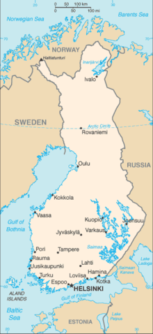
モジュール:Location map/data/Finland
表示
| 名称 | フィンランド | ||
|---|---|---|---|
| x | 100*(0.5 + 1 / (1020/1643) / 10.75*(91.711356535015-($1))*sin(0.015816248061521 *($2-25.5))) | ||
| y | 100/10.75 * (-21.461356535015 + (91.711356535015-($1))*cos(0.015816248061521 *($2-25.5))) | ||
| 画像 | Finland adm location map.svg
| ||

| |||

モジュール:Location map/data/Finlandはフィンランドの正距円筒図法地図でオーバーレイのマーカー・ラベルを表示するのに使用する地点図のLuaモジュールです。マーカーは既定値の地図や同じような地図画像において緯度と経度の座標に基いて置かれます。
使用法
次のテンプレートで"Finland"というパラメータを使用します:
{{Location map | Finland | ...}}{{Location map many | Finland | ...}}{{Location map+ | Finland | ...}}{{Location map~ | Finland | ...}}
地図パラメータ
name = フィンランド- モジュール名は地図説明文の既定値になります
image = Finland adm location map.svg- 既定値の地図画像で"Image:"や"File:"は指定しません。
x = 100*(0.5 + 1 / (1020/1643) / 10.75*(91.711356535015-($1))*sin(0.015816248061521 *($2-25.5)))- 経度に基いて地図上の位置を計算する式で、最西端は0、最東端は100になります。
y = 100/10.75 * (-21.461356535015 + (91.711356535015-($1))*cos(0.015816248061521 *($2-25.5)))- 緯度に基いて地図上の位置を計算する式で、最北端は0、最南端は100になります。
Location mapテンプレート使用例
Location map, using default map (image)
{{Location map | Finland
| width   = 180
| lat_deg = 60.171
| lon_deg = 24.938
| label   = Helsinki
}}
Location map many, using relief map (image1)
{{Location map many | Finland
| relief   = yes
| width    = 180
| caption  = Two locations in Finland
| lat1_deg = 60.17
| lon1_deg = 24.94
| label1   = Helsinki
| lat2_deg = 68.65
| lon2_deg = 27.55
| label2   = Ivalo
}}
Location map+, using AlternativeMap
{{Location map+ | Finland
| AlternativeMap = Finland physical map.svg
| width   = 180
| caption = Two locations in Finland
| places  =
  {{Location map~ | Finland
  | lat_deg = 60.17
  | lon_deg = 24.94
  | label   = Helsinki
  }}
  {{Location map~ | Finland
  | lat_deg = 68.65
  | lon_deg = 27.55
  | label   = Ivalo
  }}
}}
関連項目
Location mapテンプレート
- Template:Location map - 緯度と経度を使って1つのマークとラベルを表示します。
- Template:Location map many - 9つまでのマークとラベルを表示します。
- Template:Location map+ - 無制限にマークとラベルを表示できます。


