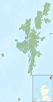
「ファイル:Shetland UK relief location map.jpg」のグローバルな使用状況
表示
このページでは、他のウィキでファイルが使用されている箇所を示しています。また、ファイルの解説ページの下部にもその情報が記載されています。

ar.wikipedia.org での使用状況
ast.wikipedia.org での使用状況
bar.wikipedia.org での使用状況
bg.wikipedia.org での使用状況
ca.wikipedia.org での使用状況
ceb.wikipedia.org での使用状況
da.wikipedia.org での使用状況
- Fair Isle
- Muckle Flugga
- Unst
- Foula
- Oxna
- West Burra
- East Burra
- Yell
- Papa Stour
- Out Stack
- Bressay
- Isle of Noss
- Lamba (Shetland)
- Skabelon:Kortpositioner Skotland Shetland
- Whalsay
- Fetlar
de.wikipedia.org での使用状況
- Whalsay
- Muckle Roe
- Trondra
- West Burra
- East Burra
- Muckle Flugga
- Mousa
- Balta (Insel)
- Vorlage:Positionskarte Schottland Shetland
- Loch of Spiggie
- Gruney
- Ramna Stacks
- Burra Voe (Northmavine)
- Loch of Cliff
- Loch of Housetter
- St Magnus Bay
- The Heag (Vementry)
- The Heag (West Burrafirth)
- West Burrafirth (Insel)
