
ファイル:VIC in Australia map.png
高解像度版はありません。
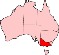
VIC_in_Australia_map.png (200 × 186 ピクセル、ファイルサイズ: 11キロバイト、MIME タイプ: image/png)
ウィキメディア・コモンズのファイルページにある説明を、以下に表示します。
|
This image was copied from wikipedia:en. The original description was:

|
この文書は、フリーソフトウェア財団発行のGNUフリー文書利用許諾書 (GNU Free Documentation License) 1.2またはそれ以降のバージョンの規約に基づき、複製や再配布、改変が許可されます。不可変更部分、表紙、背表紙はありません。このライセンスの複製は、GNUフリー文書利用許諾書という章に含まれています。 |
| このファイルはクリエイティブ・コモンズ 表示-継承 3.0 非移植ライセンスのもとに利用を許諾されています。 | ||
| ||
| このライセンスのテンプレートは、GFDLのライセンス・アップデートによりこのファイルに追加されたものです。 |

|
このファイルのベクター画像 (SVG) が利用できます。 使う目的に対し、元画像よりもSVGがより優れている場合、SVG画像を使用して下さい。
File:VIC in Australia map.png → File:Victoria in Australia.svg
|
 |
| date/time | username | edit summary |
|---|---|---|
| 03:33, 4 June 2004 | Template namespace initialisation script | |
| 21:13, 22 February 2004 | Morwen | |
| 04:45, 10 May 2003 | Tim Starling | (Created by me based on Geoscience Australia data) |
ファイルの履歴
過去の版のファイルを表示するには、その版の日時をクリックしてください。
| 日付と時刻 | サムネイル | 寸法 | 利用者 | コメント | |
|---|---|---|---|---|---|
| 現在の版 | 2005年11月8日 (火) 13:51 | | 200 × 186 (11キロバイト) | ChongDae | This image was copied from wikipedia:en. The original description was: {{GFDL}} {| border="1" ! date/time || username || edit summary |---- | 03:33, 4 June 2004 || Template namespace initialisation script || <nowiki></nowiki> |---- | 21:13, 22 February |
ファイルの使用状況
以下のページがこのファイルを使用しています:
グローバルなファイル使用状況
以下に挙げる他のウィキがこの画像を使っています:
- en-two.iwiki.icu での使用状況
- Tyers, Victoria
- Burrowa-Pine Mountain National Park
- Coopracambra National Park
- Lind National Park
- Lower Glenelg National Park
- Morwell National Park
- Mount Richmond National Park
- Terrick Terrick National Park
- The Lakes National Park
- London Bridge (Victoria)
- South East Point
- Rural City of Horsham
- Shire of Buloke
- Shire of Central Goldfields
- Shire of Campaspe
- Shire of Corangamite
- Shire of East Gippsland
- Shire of Gannawarra
- Shire of Glenelg
- Shire of Hepburn
- Shire of Hindmarsh
- Shire of Mitchell
- Shire of Moira
- Shire of Moyne
- Shire of Northern Grampians
- Shire of Southern Grampians
- Shire of Strathbogie
- Shire of Towong
- Shire of Wellington
- Shire of West Wimmera
- Alpine Shire
- Australian south-east coast drainage division
- Nilma, Victoria
- Peterborough, Victoria
- Badger Creek, Victoria
- Dixons Creek, Victoria
- Wesburn, Victoria
- Officer South, Victoria
- Pakenham Upper, Victoria
- Pakenham South, Victoria
- Cannons Creek, Victoria
- Jeparit
- Goongerah, Victoria
- Noojee
- St Andrews, Victoria
- Tarrango
- Gibson Steps
- Loch Ard Gorge
- Health Purchasing Victoria
このファイルのグローバル使用状況を表示する。