
ファイル:Stirling UK location map.svg

この SVG ファイルのこの PNG プレビューのサイズ: 583 × 599 ピクセル. その他の解像度: 234 × 240 ピクセル | 467 × 480 ピクセル | 747 × 768 ピクセル | 997 × 1,024 ピクセル | 1,993 × 2,048 ピクセル | 1,347 × 1,384 ピクセル。
元のファイル (SVG ファイル、1,347 × 1,384 ピクセル、ファイルサイズ: 1.38メガバイト)
ウィキメディア・コモンズのファイルページにある説明を、以下に表示します。
|
| 解説 |
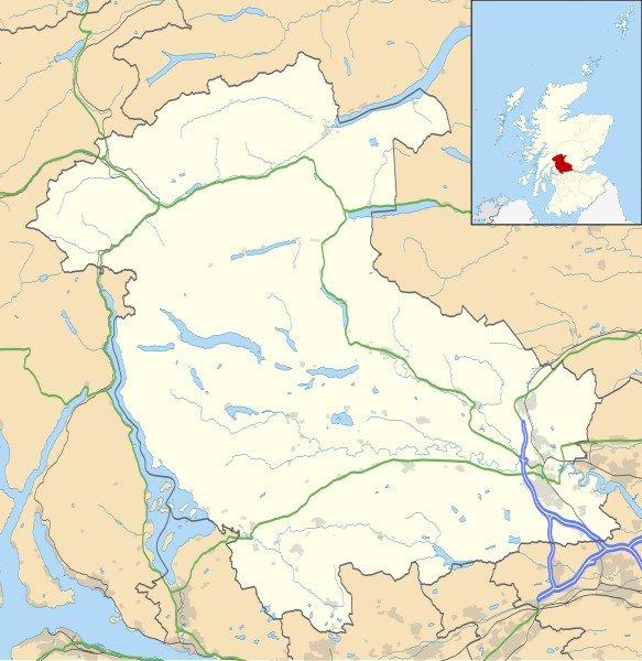
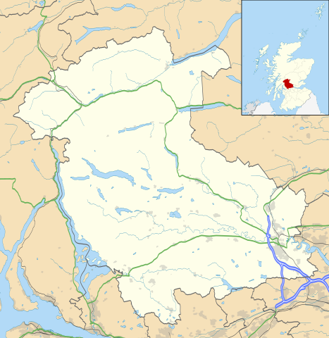
Blank map of Stirling, UK with the following information shown:
Equirectangular map projection on WGS 84 datum, with N/S stretched 175% Geographic limits:
|
| 日付 | |
| 原典 |
|
| 作者 | Nilfanion, created using Ordnance Survey data |
| 許可 (ファイルの再利用) |
このファイルはクリエイティブ・コモンズ 表示-継承 3.0 非移植ライセンスのもとに利用を許諾されています。 帰属: Contains Ordnance Survey data © Crown copyright and database right
|
| その他のバージョン | File:Stirling UK blank map.svg - Blank map |
ファイルの履歴
過去の版のファイルを表示するには、その版の日時をクリックしてください。
| 日付と時刻 | サムネイル | 寸法 | 利用者 | コメント | |
|---|---|---|---|---|---|
| 現在の版 | 2010年9月26日 (日) 20:26 | | 1,347 × 1,384 (1.38メガバイト) | Nilfanion | {{Information |Description=Blank map of Stirling, UK with the following information shown: *Administrative borders *Coastline, lakes and rivers *Roads and railways *Urban areas Equirectangular map projection on WGS 84 datum, with N/S stret |
ファイルの使用状況
以下の 5 ページがこのファイルを使用しています:
グローバルなファイル使用状況
以下に挙げる他のウィキがこの画像を使っています:
- ar.wikipedia.org での使用状況
- bg.wikipedia.org での使用状況
- ceb.wikipedia.org での使用状況
- de.wikipedia.org での使用状況
- en-two.iwiki.icu での使用状況
- Aberfoyle, Stirling
- Stirling
- List of monastic houses in Scotland
- Thornhill, Stirling
- Stirling Castle
- Bannockburn
- Bridge of Allan
- Dunblane
- Callander
- Doune
- Stirling (council area)
- Gargunnock
- Trossachs
- Glen Finglas Estate
- Doune Castle
- Drymen
- Crianlarich
- Fintry
- Dunblane Cathedral
- Tyndrum
- Brig o' Turk
- Balquhidder
- Kippen
- Buchanan Smithy
- Cambuskenneth
- Kilmahog
- Killin
- Balfron
- Cornton
- Raploch
- Auchlyne
- Blairlogie
- Buchlyvie
- Lochearnhead
- Killearn
- Stirling services
- Strathblane
- Rowardennan
- Church of the Holy Rude
- Stirling Smith Art Gallery and Museum
- Forthbank Stadium
- Blair Drummond
- Croftamie
このファイルのグローバル使用状況を表示する。