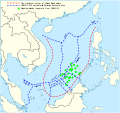
ファイル:South China Sea vector.svg
表示

この SVG ファイルのこの PNG プレビューのサイズ: 637 × 600 ピクセル. その他の解像度: 255 × 240 ピクセル | 510 × 480 ピクセル | 816 × 768 ピクセル | 1,088 × 1,024 ピクセル | 2,176 × 2,048 ピクセル | 1,004 × 945 ピクセル。
元のファイル (SVG ファイル、1,004 × 945 ピクセル、ファイルサイズ: 657キロバイト)
ファイルの履歴
過去の版のファイルを表示するには、その版の日時をクリックしてください。
| 日付と時刻 | サムネイル | 寸法 | 利用者 | コメント | |
|---|---|---|---|---|---|
| 現在の版 | 2022年2月15日 (火) 14:31 |  | 1,004 × 945 (657キロバイト) | ماني | File uploaded using svgtranslate tool (https://svgtranslate.toolforge.org/). Added translation for fa. |
| 2021年11月16日 (火) 15:44 |  | 1,004 × 945 (651キロバイト) | Goran tek-en | ppi to 96, optimized, cleaned up | |
| 2014年11月9日 (日) 19:40 |  | 1,004 × 945 (729キロバイト) | Cmglee | Label UNCLOS regions. | |
| 2014年5月19日 (月) 23:15 |  | 1,004 × 945 (723キロバイト) | Benlisquare | Fix misinformation, see en:Talk:Nine-dotted line. The red line represents the extent of China's island claims, and not sea territory claims. China's maritime territorial claims are based on distance from claimed islands, and are not demarcated by... | |
| 2014年1月23日 (木) 14:40 |  | 1,004 × 945 (722キロバイト) | Goran tek-en | User created page with UploadWizard |
ファイルの使用状況
以下のページがこのファイルを使用しています:
グローバルなファイル使用状況
以下に挙げる他のウィキがこの画像を使っています:
- af.wikipedia.org での使用状況
- cs.wikinews.org での使用状況
- en-two.iwiki.icu での使用状況
- fa.wikipedia.org での使用状況
- fi.wikipedia.org での使用状況
- fr.wikinews.org での使用状況
- fr.wiktionary.org での使用状況
- kk.wikipedia.org での使用状況
- ko.wikipedia.org での使用状況
- pl.wikipedia.org での使用状況
- ru.wikipedia.org での使用状況
- sq.wikipedia.org での使用状況
- th.wikipedia.org での使用状況
- vi.wikipedia.org での使用状況

