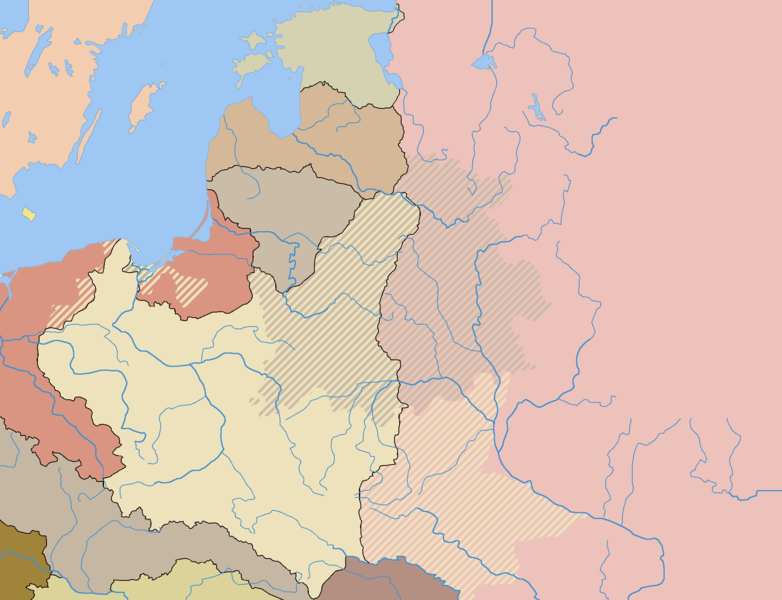
ファイル:Rzeczpospolita 1789-1920.png
表示

このプレビューのサイズ: 782 × 600 ピクセル。 その他の解像度: 313 × 240 ピクセル | 626 × 480 ピクセル | 1,001 × 768 ピクセル | 1,280 × 982 ピクセル | 2,000 × 1,534 ピクセル。
元のファイル (2,000 × 1,534 ピクセル、ファイルサイズ: 230キロバイト、MIME タイプ: image/png)
ファイルの履歴
過去の版のファイルを表示するには、その版の日時をクリックしてください。
| 日付と時刻 | サムネイル | 寸法 | 利用者 | コメント | |
|---|---|---|---|---|---|
| 現在の版 | 2016年12月13日 (火) 05:54 |  | 2,000 × 1,534 (230キロバイト) | Latviesu Australiets | Corrected Latvian and Estonian borders to pre-ww2 changes |
| 2010年8月6日 (金) 12:01 |  | 2,000 × 1,534 (235キロバイト) | Dcoetzee | Remove watermark | |
| 2005年5月31日 (火) 18:23 |  | 2,000 × 1,534 (221キロバイト) | Halibutt | The map shows the borders in Central Europe after the Polish-Bolshevik War (as of 1922). The areas marked with lines had been part of the Polish-Lithuanian Commonwealth and then Poland prior to the partitions, and were not reclaimed by Poland or Lithuania |
ファイルの使用状況
以下のページがこのファイルを使用しています:
グローバルなファイル使用状況
以下に挙げる他のウィキがこの画像を使っています:
- bg.wikipedia.org での使用状況
- br.wikipedia.org での使用状況
- ca.wikipedia.org での使用状況
- de.wikipedia.org での使用状況
- el.wikipedia.org での使用状況
- en-two.iwiki.icu での使用状況
- es.wikipedia.org での使用状況
- hu.wikipedia.org での使用状況
- it.wikipedia.org での使用状況
- lt.wikipedia.org での使用状況
- pl.wikipedia.org での使用状況
- ro.wikipedia.org での使用状況
- sl.wikipedia.org での使用状況
- sr.wikipedia.org での使用状況
- zh-two.iwiki.icu での使用状況


