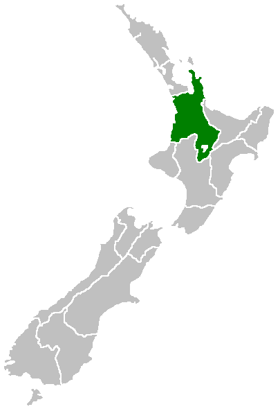
ファイル:Position of Waikato Region.png
表示
Position_of_Waikato_Region.png (405 × 590 ピクセル、ファイルサイズ: 7キロバイト、MIME タイプ: image/png)
ファイルの履歴
過去の版のファイルを表示するには、その版の日時をクリックしてください。
| 日付と時刻 | サムネイル | 寸法 | 利用者 | コメント | |
|---|---|---|---|---|---|
| 現在の版 | 2005年4月27日 (水) 07:41 |  | 405 × 590 (7キロバイト) | Domie~commonswiki | Region of New Zealand, position on the map (source:English Wiki) {{PD}} Category:Maps of New Zealand |
ファイルの使用状況
以下のページがこのファイルを使用しています:
グローバルなファイル使用状況
以下に挙げる他のウィキがこの画像を使っています:
- en-two.iwiki.icu での使用状況
- Mamaku Ranges
- Cape Colville
- Motukawao Islands
- Coromandel Range
- Slipper Island
- Lake Maraetai
- Lake Arapuni
- Lake Waikare
- Mangateparu
- Māhoenui
- Ōhakuri Dam
- Template:Waikato-geo-stub
- Huntly Power Station
- Lady Knox Geyser
- Horseshoe Lake (New Zealand)
- Lake Rotopounamu
- Awakino
- Kārewa / Gannet Island
- Waihi Village
- Hauauru ma raki
- Te Huka Power Station
- Portal:Monarchy
- Te Rapa cogeneration
- Te Mihi Power Station
- Wairakei Power Station
- Te Uku Wind Farm
- Aratiatia Power Station
- Ohaaki Power Station
- Poihipi Power Station
- Rotokawa Power Station
- Horahora Power Station
- Karāpiro Power Station
- Nga Awa Purua Power Station
- Madonna Falls
- Ben Lomond (Waikato)
- Tongariro Power Scheme
- Atiamuri Power Station
- Maraetai Power Station
- Arapuni Power Station
- Meremere Power Station
- Whakamaru Dam
- Wairere Falls
- Seabird Coast
- Ngatamariki Power Station
- Non-sovereign monarchy
- Whitianga Festival of Speed
- List of localities in Waikato
- Waikato County
- Hamilton Town Belt
- Grandview Heights, New Zealand
このファイルのグローバル使用状況を表示する。


