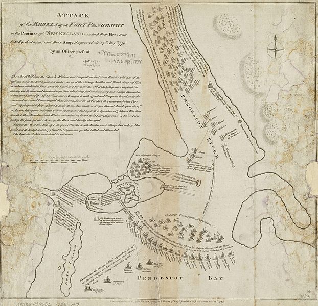
ファイル:PenobscotExpedition1779.jpg
表示

このプレビューのサイズ: 622 × 600 ピクセル。 その他の解像度: 249 × 240 ピクセル | 498 × 480 ピクセル | 796 × 768 ピクセル | 1,062 × 1,024 ピクセル | 2,124 × 2,048 ピクセル | 3,588 × 3,460 ピクセル。
元のファイル (3,588 × 3,460 ピクセル、ファイルサイズ: 5.89メガバイト、MIME タイプ: image/jpeg)
ファイルの履歴
過去の版のファイルを表示するには、その版の日時をクリックしてください。
| 日付と時刻 | サムネイル | 寸法 | 利用者 | コメント | |
|---|---|---|---|---|---|
| 現在の版 | 2009年4月8日 (水) 14:50 |  | 3,588 × 3,460 (5.89メガバイト) | Magicpiano | Full resolution image (same source), rotated and cropped. |
| 2009年1月9日 (金) 20:44 |  | 906 × 906 (608キロバイト) | Magicpiano | Original, now rotated and cropped. | |
| 2009年1月9日 (金) 19:59 |  | 927 × 1,024 (844キロバイト) | Magicpiano | {{Information |Description={{en|1=This is a 1785 map depicting the 1779 naval action of the en:Penobscot Expedition. The original map measures 36.0x38.0cm. The caption reads: Attack of the rebels upon Fort Penobscot in the province of New England in |
ファイルの使用状況
以下のページがこのファイルを使用しています:
グローバルなファイル使用状況
以下に挙げる他のウィキがこの画像を使っています:
- en-two.iwiki.icu での使用状況
- fr.wikipedia.org での使用状況
- it.wikipedia.org での使用状況
- ru.wikipedia.org での使用状況


