
ファイル:North Lanarkshire UK location map.svg

この SVG ファイルのこの PNG プレビューのサイズ: 509 × 599 ピクセル. その他の解像度: 204 × 240 ピクセル | 408 × 480 ピクセル | 653 × 768 ピクセル | 870 × 1,024 ピクセル | 1,740 × 2,048 ピクセル | 1,176 × 1,384 ピクセル。
元のファイル (SVG ファイル、1,176 × 1,384 ピクセル、ファイルサイズ: 1.14メガバイト)
ウィキメディア・コモンズのファイルページにある説明を、以下に表示します。
|
| 解説 |
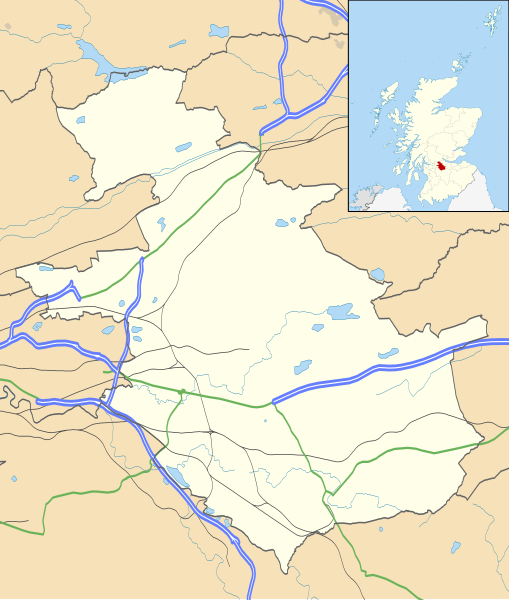
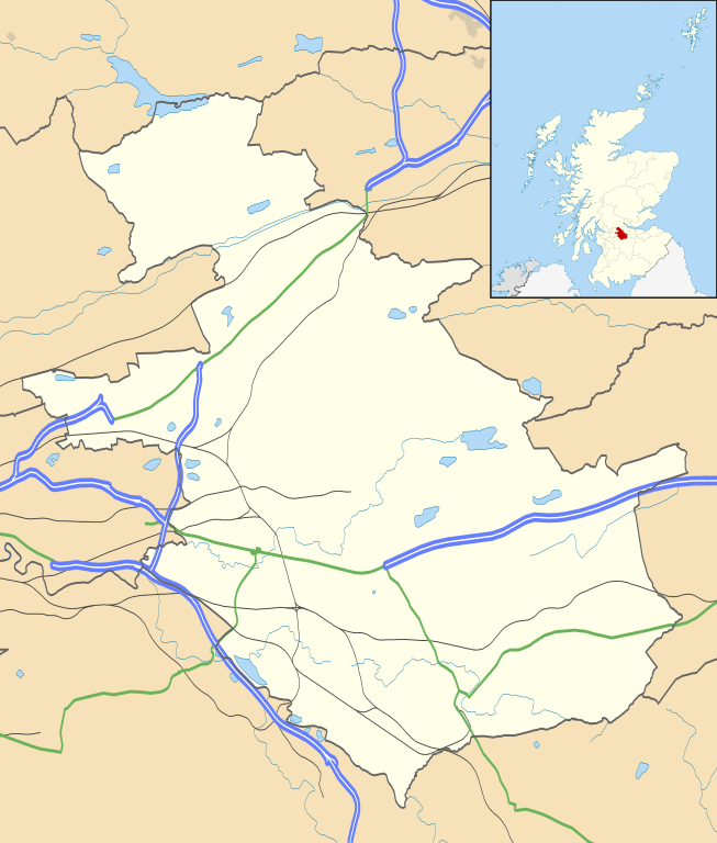
Blank map of North Lanarkshire, UK with the following information shown:
Equirectangular map projection on WGS 84 datum, with N/S stretched 175% Geographic limits:
|
| 日付 | |
| 原典 |
|
| 作者 | Nilfanion, created using Ordnance Survey data |
| 許可 (ファイルの再利用) |
このファイルはクリエイティブ・コモンズ 表示-継承 3.0 非移植ライセンスのもとに利用を許諾されています。 帰属: Contains Ordnance Survey data © Crown copyright and database right
|
| その他のバージョン | File:North Lanarkshire UK blank map.svg - Blank map |
ファイルの履歴
過去の版のファイルを表示するには、その版の日時をクリックしてください。
| 日付と時刻 | サムネイル | 寸法 | 利用者 | コメント | |
|---|---|---|---|---|---|
| 現在の版 | 2010年9月26日 (日) 20:20 | | 1,176 × 1,384 (1.14メガバイト) | Nilfanion | {{Information |Description=Blank map of North Lanarkshire, UK with the following information shown: *Administrative borders *Coastline, lakes and rivers *Roads and railways *Urban areas Equirectangular map projection on WGS 84 dat |
ファイルの使用状況
以下の 5 ページがこのファイルを使用しています:
グローバルなファイル使用状況
以下に挙げる他のウィキがこの画像を使っています:
- ar.wikipedia.org での使用状況
- bg.wikipedia.org での使用状況
- ceb.wikipedia.org での使用状況
- de.wikipedia.org での使用状況
- en-two.iwiki.icu での使用状況
- Airdrie, North Lanarkshire
- North Lanarkshire
- Motherwell
- Coatbridge
- Kilsyth
- Wishaw
- Fir Park
- Bellshill
- Cleland, North Lanarkshire
- Bargeddie
- Excelsior Stadium
- Calderbank
- Abronhill
- Condorrat
- Greenfaulds
- Millerston
- Harthill, Scotland
- Shotts
- Newarthill
- Carfin
- Black Hill transmitting station
- Croy, North Lanarkshire
- Plains, North Lanarkshire
- Cambusnethan
- Coltness
- Newhouse, North Lanarkshire
- University Hospital Monklands
- Broadwood Stadium
- Kirk o' Shotts transmitting station
- Dalserf
- Auchinloch
- Holytown
- Dullatur
- Banton, North Lanarkshire
- Kelvinhead
- Castlecary
- Chryston
- Cliftonhill
- Pather
- Ravenscraig
- Luggiebank
このファイルのグローバル使用状況を表示する。