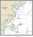
ファイル:NRHA 1.png
表示

このプレビューのサイズ: 533 × 600 ピクセル。 その他の解像度: 213 × 240 ピクセル | 426 × 480 ピクセル | 682 × 768 ピクセル | 910 × 1,024 ピクセル | 2,202 × 2,478 ピクセル。
元のファイル (2,202 × 2,478 ピクセル、ファイルサイズ: 2.02メガバイト、MIME タイプ: image/png)
ファイルの履歴
過去の版のファイルを表示するには、その版の日時をクリックしてください。
| 日付と時刻 | サムネイル | 寸法 | 利用者 | コメント | |
|---|---|---|---|---|---|
| 現在の版 | 2015年9月4日 (金) 06:28 |  | 2,202 × 2,478 (2.02メガバイト) | Innotata | Transferred from en.wikipedia |
ファイルの使用状況
以下のページがこのファイルを使用しています:
グローバルなファイル使用状況
以下に挙げる他のウィキがこの画像を使っています:
- ceb.wikipedia.org での使用状況
- de.wikipedia.org での使用状況
- en-two.iwiki.icu での使用状況
- Westchester County, New York
- Columbia Island (New York)
- Travers Island, New York
- Pea Island (New Rochelle, New York)
- Titus Mill-Pond & New York State Tidal Wetlands
- New Rochelle Harbor (Long Island Sound)
- Echo Bay (Long Island Sound)
- Davenport Neck
- Premium Point, New Rochelle
- Pine Island (New Rochelle)
- Premium Mill-Pond
- fi.wikipedia.org での使用状況
- fr.wikipedia.org での使用状況
- www.wikidata.org での使用状況
