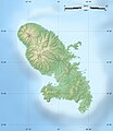
ファイル:Martinique department location map.svg
表示

この SVG ファイルのこの PNG プレビューのサイズ: 518 × 599 ピクセル. その他の解像度: 207 × 240 ピクセル | 415 × 480 ピクセル | 664 × 768 ピクセル | 885 × 1,024 ピクセル | 1,770 × 2,048 ピクセル | 961 × 1,112 ピクセル。
元のファイル (SVG ファイル、961 × 1,112 ピクセル、ファイルサイズ: 131キロバイト)
ファイルの履歴
過去の版のファイルを表示するには、その版の日時をクリックしてください。
| 日付と時刻 | サムネイル | 寸法 | 利用者 | コメント | |
|---|---|---|---|---|---|
| 現在の版 | 2008年8月16日 (土) 20:46 |  | 961 × 1,112 (131キロバイト) | Sting | == Summary == {{Location|14|39|00|N|61|00|45|W|scale:500000}} <br/> {{Information |Description={{en|Blank administrative map of the region and department of Martinique, France, for geo-location purpose, with arrondissements boundaries.} |
ファイルの使用状況
以下の 4 ページがこのファイルを使用しています:
グローバルなファイル使用状況
以下に挙げる他のウィキがこの画像を使っています:
- af.wikipedia.org での使用状況
- als.wikipedia.org での使用状況
- an.wikipedia.org での使用状況
- ar.wikipedia.org での使用状況
- ast.wikipedia.org での使用状況
- az.wikipedia.org での使用状況
- be-tarask.wikipedia.org での使用状況
- be.wikipedia.org での使用状況
- bg.wikipedia.org での使用状況
- bs.wikipedia.org での使用状況
- ca.wikipedia.org での使用状況
- ceb.wikipedia.org での使用状況
- Plantilya:Location map Martinique
- Robert
- Marin (pagklaro)
- Saint-Pierre (pagklaro)
- Bellefontaine (pagklaro)
- Pointe Lézarde
- Îlet Frégate
- Baie des Flamands
- Pearl Rock
- Bellevue
- Mount of Olives
- Jacob Hill
- Morne Rouge
- Morne Blanc
- La Pointe
- Pointe du Fort
- Martinique Passage
- Martinique Channel
- Marigot
- Morne Daniel
- Pointe des Salines
- Pointe Rouge
- Rivière Rouge
- Mont Pelé
- Hospital Cay
このファイルのグローバル使用状況を表示する。


