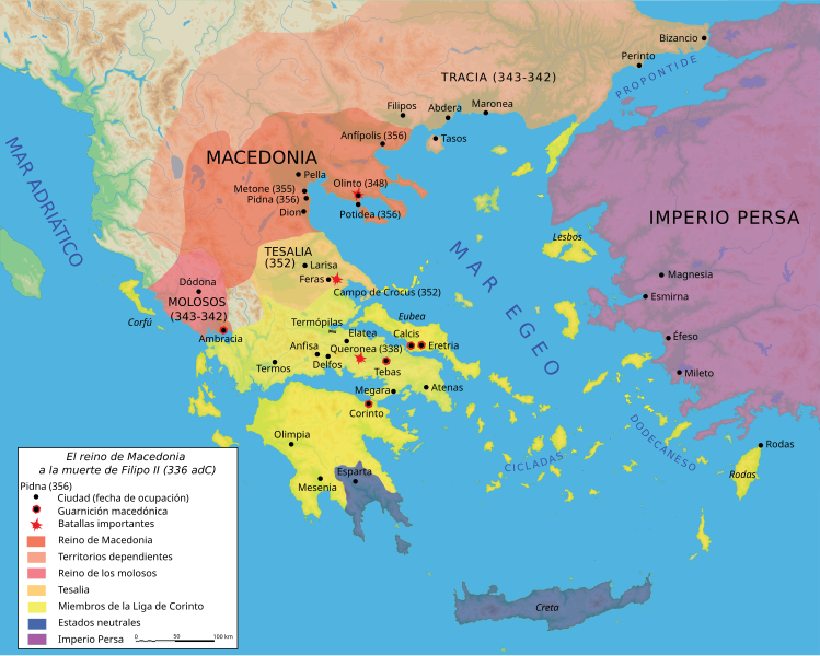
ファイル:Map Macedonia 336 BC-es.svg
表示

この SVG ファイルのこの PNG プレビューのサイズ: 749 × 600 ピクセル. その他の解像度: 300 × 240 ピクセル | 600 × 480 ピクセル | 960 × 768 ピクセル | 1,279 × 1,024 ピクセル | 2,559 × 2,048 ピクセル | 992 × 794 ピクセル。
元のファイル (SVG ファイル、992 × 794 ピクセル、ファイルサイズ: 3.41メガバイト)
ファイルの履歴
過去の版のファイルを表示するには、その版の日時をクリックしてください。
| 日付と時刻 | サムネイル | 寸法 | 利用者 | コメント | |
|---|---|---|---|---|---|
| 現在の版 | 2007年6月27日 (水) 22:24 |  | 992 × 794 (3.41メガバイト) | Bibi Saint-Pol | fix several SVG problems; restore legend: this is part of the map |
| 2017年3月20日 (月) 08:11 |  | 1,058 × 847 (4.07メガバイト) | Rowanwindwhistler | https://en-two.iwiki.icu/wiki/Wikipedia:WikiProject_Maps/Conventions Fake text added | |
| 2016年2月25日 (木) 07:36 |  | 992 × 794 (3.59メガバイト) | Rowanwindwhistler | Cleaner version, height per layer for easier modification, duplication of islands removed. | |
| 2016年2月25日 (木) 06:56 |  | 992 × 794 (3.06メガバイト) | Rowanwindwhistler | Battle symbols on top | |
| 2016年2月22日 (月) 09:28 |  | 992 × 794 (3.06メガバイト) | Rowanwindwhistler | Eubea corrected | |
| 2015年12月29日 (火) 19:20 |  | 992 × 794 (3.06メガバイト) | Rowanwindwhistler | No transparency for the sea | |
| 2015年12月29日 (火) 19:17 |  | 992 × 794 (3.06メガバイト) | Rowanwindwhistler | Coast added, sea colour changed as per https://en-two.iwiki.icu/wiki/Wikipedia:WikiProject_Maps/Conventions | |
| 2007年6月27日 (水) 22:29 |  | 992 × 794 (3.41メガバイト) | Bibi Saint-Pol | {{Information |Description= {{es|Mapa del reino de Filipo II a su muerte, 336 adC}} Source=Own work using Adobe Illustrator (data from R. Ginouvès and al., ''La Macédoine'', Paris, 1992). Translated from [[:Image:Map Macedonia 336 | |
| 2007年6月13日 (水) 23:54 |  | 993 × 794 (3.43メガバイト) | Ignacio Icke | -legend off | |
| 2007年6月12日 (火) 23:29 |  | 993 × 794 (3.43メガバイト) | Ignacio Icke | trying to solve the rectangles thing |
ファイルの使用状況
このファイルを使用しているページはありません。
グローバルなファイル使用状況
以下に挙げる他のウィキがこの画像を使っています:
- ast.wikipedia.org での使用状況
- es.wikipedia.org での使用状況
- eu.wikipedia.org での使用状況
- gl.wikipedia.org での使用状況
- hu.wikipedia.org での使用状況
- la.wikipedia.org での使用状況
- pl.wikipedia.org での使用状況
- sq.wikipedia.org での使用状況


