ファイル:El Paso-Las Cruces CSA.png
表示
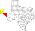
El_Paso-Las_Cruces_CSA.png (615 × 550 ピクセル、ファイルサイズ: 44キロバイト、MIME タイプ: image/png)
ファイルの履歴
過去の版のファイルを表示するには、その版の日時をクリックしてください。
| 日付と時刻 | サムネイル | 寸法 | 利用者 | コメント | |
|---|---|---|---|---|---|
| 現在の版 | 2018年4月1日 (日) 08:45 |  | 615 × 550 (44キロバイト) | Yassie | minor modification |
| 2018年4月1日 (日) 00:09 |  | 615 × 550 (44キロバイト) | Yassie | {{Information |Description= Locator map of El Paso-Las Cruces Combined Statistical Area in the Western Texas and Southern New Mexico, in the United States. The two components of the CSA are colored separately: * El Paso, TX MSA: red * Las Cruces, NM MSA (Doña Ana County) : yellow |Source=Modified from [http://www2.census.gov/geo/maps/general_ref/cousub_outline/cen2k_pgsz/tx_cosub.pdf this] {{w|United States Census Bureau}} file, based on [https://www.whitehouse.gov/sites/whitehouse.gov/files/... |
ファイルの使用状況
以下のページがこのファイルを使用しています:

