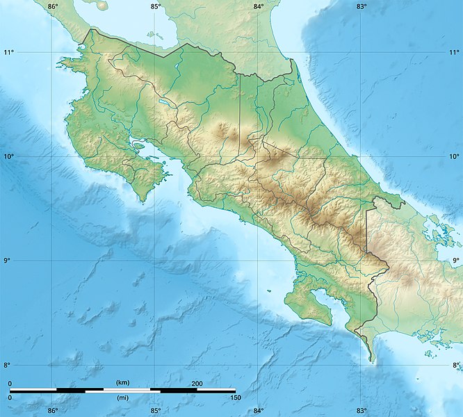
ファイル:Costa Rica relief location map.jpg
表示

このプレビューのサイズ: 666 × 600 ピクセル。 その他の解像度: 267 × 240 ピクセル | 533 × 480 ピクセル | 853 × 768 ピクセル | 1,148 × 1,034 ピクセル。
元のファイル (1,148 × 1,034 ピクセル、ファイルサイズ: 841キロバイト、MIME タイプ: image/jpeg)
ファイルの履歴
過去の版のファイルを表示するには、その版の日時をクリックしてください。
| 日付と時刻 | サムネイル | 寸法 | 利用者 | コメント | |
|---|---|---|---|---|---|
| 現在の版 | 2022年3月30日 (水) 22:51 |  | 1,148 × 1,034 (841キロバイト) | Sting | New map using new data |
| 2021年11月4日 (木) 01:32 |  | 1,148 × 1,034 (906キロバイト) | RoboQwezt0x7CB | hand edited to remove non-existing waterbodies, used lower elevation green shade to bucket fill (best I can do without the tools to generate the map) particulary in the south of the country (probably an altitude render/clipping error), kept some that are hydroelectric plant's reservoirs | |
| 2010年7月19日 (月) 12:11 |  | 1,148 × 1,034 (500キロバイト) | Sting | Color profile | |
| 2008年7月30日 (水) 15:05 |  | 1,148 × 1,034 (491キロバイト) | Sting | - border | |
| 2008年6月13日 (金) 14:40 |  | 1,148 × 1,034 (499キロバイト) | Sting | Several improvements | |
| 2008年6月12日 (木) 01:21 |  | 1,148 × 1,034 (501キロバイト) | Sting | Correction on shaded layer | |
| 2008年6月12日 (木) 01:09 |  | 1,148 × 1,034 (504キロバイト) | Sting | == Summary == {{Location|10|00|00|N|84|00|00|W|scale:2000000}} <br/> {{Information |Description={{en|Blank relief map of Costa Rica for geo-location purpose.<br/>''Note :'' The ''Isla del Coco'', out of the map, is not shown.<br/>Scale |
ファイルの使用状況
以下の 8 ページがこのファイルを使用しています:
グローバルなファイル使用状況
以下に挙げる他のウィキがこの画像を使っています:
- ar.wikipedia.org での使用状況
- ast.wikipedia.org での使用状況
- azb.wikipedia.org での使用状況
- az.wikipedia.org での使用状況
- ban.wikipedia.org での使用状況
- ba.wikipedia.org での使用状況
- be.wikipedia.org での使用状況
- bg.wikipedia.org での使用状況
- bn.wikipedia.org での使用状況
- bs.wikipedia.org での使用状況
- ca.wikipedia.org での使用状況
- ceb.wikipedia.org での使用状況
- ce.wikipedia.org での使用状況
- ckb.wikipedia.org での使用状況
- cs.wikipedia.org での使用状況
このファイルのグローバル使用状況を表示する。


