
ファイル:Cambridgeshire UK location map.svg

この SVG ファイルのこの PNG プレビューのサイズ: 533 × 600 ピクセル. その他の解像度: 213 × 240 ピクセル | 426 × 480 ピクセル | 682 × 768 ピクセル | 910 × 1,024 ピクセル | 1,820 × 2,048 ピクセル | 1,125 × 1,266 ピクセル。
元のファイル (SVG ファイル、1,125 × 1,266 ピクセル、ファイルサイズ: 1.79メガバイト)
ウィキメディア・コモンズのファイルページにある説明を、以下に表示します。
|
| 解説 |
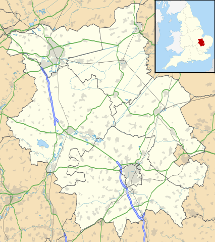
Map of Cambridgeshire, UK with the following information shown:
Equirectangular map projection on WGS 84 datum, with N/S stretched 160% Geographic limits:
|
| 日付 | |
| 原典 |
|
| 作者 | Nilfanion, created using Ordnance Survey data |
| 許可 (ファイルの再利用) |
このファイルはクリエイティブ・コモンズ 表示-継承 3.0 非移植ライセンスのもとに利用を許諾されています。 帰属: Contains Ordnance Survey data © Crown copyright and database right
|
| その他のバージョン | File:Cambridgeshire UK district map (blank).svg - Blank map |
.svg)
ファイルの履歴
過去の版のファイルを表示するには、その版の日時をクリックしてください。
| 日付と時刻 | サムネイル | 寸法 | 利用者 | コメント | |
|---|---|---|---|---|---|
| 現在の版 | 2010年9月26日 (日) 18:41 | | 1,125 × 1,266 (1.79メガバイト) | Nilfanion | {{Information |Description=Map of Cambridgeshire, UK with the following information shown: *Administrative borders *Coastline, lakes and rivers *Roads and railways *Urban areas Equirectangular map projection on WGS 84 datum, with N/S |
ファイルの使用状況
以下の 6 ページがこのファイルを使用しています:
グローバルなファイル使用状況
以下に挙げる他のウィキがこの画像を使っています:
- ar.wikipedia.org での使用状況
- bg.wikipedia.org での使用状況
- ceb.wikipedia.org での使用状況
- en-two.iwiki.icu での使用状況
- Peterborough
- Kimbolton Castle
- St Ives, Cambridgeshire
- Littleport
- Ramsey Abbey
- St Neots
- Eye, Cambridgeshire
- Eye Green
- Werrington, Peterborough
- Grantchester
- Wisbech
- Coton, Cambridgeshire
- Flag Fen
- Burwell, Cambridgeshire
- Huntingdon
- Perry, Cambridgeshire
- Gamlingay
- Godmanchester
- Eynesbury, Cambridgeshire
- Eaton Ford
- Eaton Socon
- Kimbolton, Cambridgeshire
- Chesterton, Cambridge
- Cambourne
- Soham
- Duxford
- Ramsey, Cambridgeshire
- Orton, Peterborough
- Whittlesey
- March, Cambridgeshire
- Girton College, Cambridge
- Chatteris
- Caldecote, South Cambridgeshire
- Addenbrooke's Hospital
- The Abingtons, Cambridgeshire
- Meldreth
- Denny Abbey
- Wimpole Estate
- Anglesey Abbey
- Hampton, Peterborough
- Thorpe Hall (Peterborough)
- Isleham
- Witcham
- Fulbourn
- Great Wilbraham
- Little Wilbraham
このファイルのグローバル使用状況を表示する。