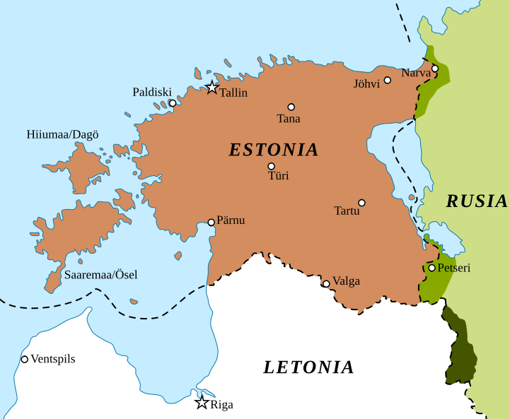
ファイル:BalticStatesBorders.svg
表示

この SVG ファイルのこの PNG プレビューのサイズ: 721 × 593 ピクセル. その他の解像度: 292 × 240 ピクセル | 584 × 480 ピクセル | 934 × 768 ピクセル | 1,245 × 1,024 ピクセル | 2,490 × 2,048 ピクセル。
元のファイル (SVG ファイル、721 × 593 ピクセル、ファイルサイズ: 229キロバイト)
ファイルの履歴
過去の版のファイルを表示するには、その版の日時をクリックしてください。
| 日付と時刻 | サムネイル | 寸法 | 利用者 | コメント | |
|---|---|---|---|---|---|
| 現在の版 | 2022年2月6日 (日) 11:03 |  | 721 × 593 (229キロバイト) | Rowanwindwhistler | New colours for Latvian territory handed over to Russia |
| 2022年2月6日 (日) 10:59 |  | 721 × 593 (226キロバイト) | Rowanwindwhistler | Improved version. Lines closer to the original ones, lighter colours. Fake text added | |
| 2015年8月11日 (火) 06:39 |  | 721 × 593 (115キロバイト) | Rowanwindwhistler | Sea border | |
| 2015年8月11日 (火) 06:36 |  | 721 × 593 (114キロバイト) | Rowanwindwhistler | Colours from http://colorbrewer2.org/ & https://en-two.iwiki.icu/wiki/Wikipedia:WikiProject_Maps/Conventions | |
| 2010年1月8日 (金) 22:47 |  | 721 × 593 (93キロバイト) | Rowanwindwhistler | {{Information |Description={{en|1=border changes of Estonia and Latvia between 1939 and 2001 Border changes drawn based on Goode's World Atlas, editions 1934 & 2001, RAND&McNALLY, CHICAGO}} {{es|1=Cambios territoriales en Estonia y Letonia desde el comie |
ファイルの使用状況
以下のページがこのファイルを使用しています:
グローバルなファイル使用状況
以下に挙げる他のウィキがこの画像を使っています:
- ca.wikipedia.org での使用状況
- es.wikipedia.org での使用状況
- fr.wikipedia.org での使用状況
- lt.wikipedia.org での使用状況


