コンテンツにスキップ

英文维基 | 中文维基 | 日文维基 | 草榴社区

ファイル:Avenio vulgo Avignon (Atlas van Loon).jpg

ページのコンテンツが他言語でサポートされていません。

元のファイル (5,500 × 4,334 ピクセル、ファイルサイズ: 4.31メガバイト、MIME タイプ: image/jpeg)

概要

作者
ピエテル・モルティエ  (1661–1711)  wikidata:Q7192808
 
別名
Pierre Mortier; Pieter Mortier (I); Pieter Mortier
説明 オランダの 地図製作者、版画家、出版者、印刷職人、銅板彫刻家およびprintseller
生年月日・没年月日 1661年 ウィキデータを編集 1711年 ウィキデータを編集
出生地・死没地 ライデン ウィキデータを編集 アムステルダム ウィキデータを編集
活動拠点
パリ (1681年–1685年); アムステルダム (1685年–1711年) ウィキデータを編集
典拠管理
creator QS:P170,Q7192808
解説
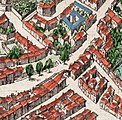
English: Title:Avenio Vulgo Avignon

This plate is from the Atlas Van Loon, which contains two volumes of the French edition of the Willem Blaeu's Atlas Maior, covering France and Switzerland, from 1663.

The Bibliothèque nationale de France (BNF) has an uncoloured version of this engraving: https://catalogue.bnf.fr/ark:/12148/cb40571320g A scan of this copy is available from the Gallica website: https://gallica.bnf.fr/ark:/12148/btv1b53079287p The BNF gives the date as 1690 and the size as 50 x 60 cm.

In the BNF copy, the cartouche at the bottom right containing the scale bar includes the text "A Amsterdam, Pierre Mortier, Avec Privilege". In addition, at the bottom right hand corner of the engraving is the number: "LXXI"

According to the BNF, plate number LXXI is from the second volume of the Nouveau theatre d'Italie ou description exacte de ses villes, palais, églises ... et les cartes géographiques de toutes ses provinces...sur les Desseins de feu Monsieur Jean Blaeu that was published by Pierre Mortier in Amsterdam in 1704.

A copy of an uncoloured versions of this engraving is reproduced as Plate 2 in: Gagnière, S.; Granier, J. (1978). Images du Vieil Avignon (in French). Avignon: Rullière-Libeccio. Plate 2. This copy includes additional text in the cartouche at the bottom right: "A Amsterdam, Pierre Mortier, Avec Privilege, LXXI" (the LXXI is included within the cartouche)

The engraving is a copy of an earlier map in 8 panels dated 1618 in the Bibliothèque Nationale de France (Va 84 Tome 1 H 159061-8). This is not currently available from Gallica. The panels of the 1618 map are reproduced in the 1958 book Évocation du Vieil Avignon by Joseph Girard. The 1618 map gives the authors as Marcus Antonius Gandolfus (Marco Antonio Gandolfo) and Theodorus Hochstraie (Théodore Hoochstraten, an engraver from The Hague) (Girard 1958, pp. 76-77). A low quality image of the 1618 map is available online on page 10 in the document available here. For more information on the 1618 map see: Breton, Alain (1986) "Prix-fait de la gravure du plan de 1618", Annuaire de la Société des amis du Palais des papes et des monuments d'Avignon, pp. 63-64.
日付 1663年
date QS:P571,+1663-00-00T00:00:00Z/9
備考

There are difficulties with the depiction of the Pont Saint-Bénézet. Although less obvious in this picture, the 1618 version shows a partially obscured first pier of the bridge on the river bank (on the Avignon side). The second pier sits in the river and has a cutwater. The chapel is depicted on the third pier but in reality sits on the second pier. There are 23 piers depicted rather than the actual 22. If the partially obscured first pier is ignored then the chapel sits on correct pier but arch 6 is shown as collapsed. In the detailed drawings by the Jesuit architect Étienne Martellange arch 6 is shown as intact but arch 7 collapsed in 1608, 1609 and 1617.

The river to the north of the town is labelled "SORGUE RIVIERE". This is an error - the river is the Rhône. The same error is present on the original 1618 map. (see Girard 1958, p. 78 "une erreur surprenante dans un document si étudié". Girard includes the panels showing La Sorgue between pages 150 and 151)
参考文献 Girard, Joseph (1958). Évocation du Vieil Avignon (in French). Paris: Les Éditions de Minuit. OCLC 5391399.
情報源/撮影者 Atlas van Loon (Atlases from the Maritime Museum of the Scheepvaartmuseum)
その他のバージョン
File:Civitatis Avenionis omnimq 1618 map of Avignon.jpg
The 1618 map from which this map was copied
File:Porte St Lazare on 17th century Avignon map.jpg
Detail showing the Porte Saint-Lazare
File:Portail Magnanen on 17th century Avignon map.jpg
Detail showing the the two gates of the Portail Magnanen

ライセンス

このファイルは、パブリックドメインの状態にある平面的な美術の著作物を写真術によって忠実に複製したものです。このような複製はアメリカ合衆国においてパブリックドメインの状態にあります。その他の地域では再利用に制限がかかる場合があります。詳しくはReuse of PD-Art photographsをご覧ください。美術の著作物としての原図は、次の理由によりパブリックドメインの状態にあります。
Public domain

この著作物は、著作権の保護期間が著作者の死後100年以下である国・地域においてパブリックドメインの状態にあります。


この著作物は1929年1月1日以前に公表され、又はアメリカ合衆国著作権局に登録されたため、アメリカ合衆国においてパブリックドメインの状態にあります。

このファイルは著作権法の既知の制約(隣接権や関連する権利を含む)から自由であると特定されています。

キャプション

このファイルの内容を1行で記述してください

このファイルに描写されている項目

題材

321f59f045bb37442795c54c8766a09c32d22ac8

4,516,572 バイト

4,334 ピクセル

5,500 ピクセル

ファイルの履歴

過去の版のファイルを表示するには、その版の日時をクリックしてください。

日付と時刻サムネイル寸法利用者コメント
現在の版2008年12月21日 (日) 00:102008年12月21日 (日) 00:10時点における版のサムネイル5,500 × 4,334 (4.31メガバイト)Kweniston{{Information |Description={{en|1=Avignon.}} |Source=Atlas van Loon |Author=unknown |Date=1649 |Permission= |other_versions= }} <!--{{ImageUpload|full}}--> Category:Avignon Category:Atlas van Loon

以下のページがこのファイルを使用しています:

グローバルなファイル使用状況

以下に挙げる他のウィキがこの画像を使っています:

メタデータ