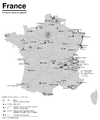
ファイル:ÖPNV-Systeme auf den Britischen Inseln.png
表示

このプレビューのサイズ: 407 × 599 ピクセル。 その他の解像度: 163 × 240 ピクセル | 326 × 480 ピクセル | 522 × 768 ピクセル | 696 × 1,024 ピクセル | 1,845 × 2,715 ピクセル。
元のファイル (1,845 × 2,715 ピクセル、ファイルサイズ: 512キロバイト、MIME タイプ: image/png)
ファイルの履歴
過去の版のファイルを表示するには、その版の日時をクリックしてください。
| 日付と時刻 | サムネイル | 寸法 | 利用者 | コメント | |
|---|---|---|---|---|---|
| 現在の版 | 2015年7月10日 (金) 05:36 |  | 1,845 × 2,715 (512キロバイト) | Chumwa | {{Information |Description= *{{de|Karte der streckengebundenen Nahverkehrssysteme (S-Bahn, U-Bahn, Stadtbahn, Straßenbahn, O-Bus) des Vereinigten Königreichs und Irlands}} *{{en|Map of fixed-route public transport systems (suburban railways, Rapid Tr... |
ファイルの使用状況
以下のページがこのファイルを使用しています:
グローバルなファイル使用状況
以下に挙げる他のウィキがこの画像を使っています:
- cs.wikipedia.org での使用状況
- de.wikipedia.org での使用状況
- en-two.iwiki.icu での使用状況
- sk.wikipedia.org での使用状況


